
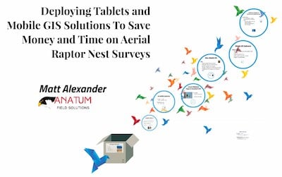
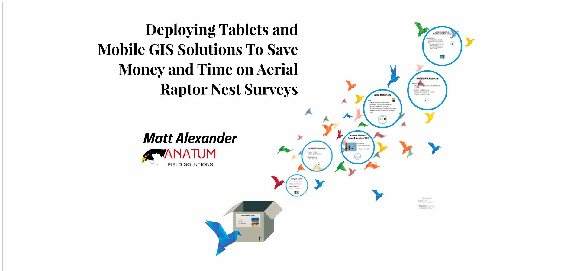
Tablets & Mobile GIS to Save Money & Time on Aerial Raptor Nest Surveys
Posted by Matt on 6/8/2016 to
Conference Presentations
This talk was presented at the 2016 Energy, Utility, & Environment Conference in San Diego. It highlights our experience using tablets to speed up raptor nest surveys from helicopters.
ESRI Collector Supports High-Precision GNSS
Posted by Matt on 6/1/2016 to
Adopting Mobile GIS
Esri has been chasing the rest of the mobile GIS app world for a long time. But, with this summer’s update that adds on-the-fly datum transformations, Collector catapults itself above almost all competitors in the GNSS interface category. We are excited to spend more time in the Collector work flow with RTK equipment, but hope that Collector continues to develop additional functionality to keep up with competitors that have more robust data forms.
RTK Setup with Eos Arrow 200 and Arrow Gold for iOS
Posted by AFS on 5/3/2016 to
Tutorial Videos
Video tutorial for setting up RTK corrections with the Arrow 200 and Arrow Gold for iOS.
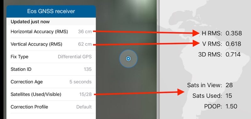
Field Testing Submeter Bluetooth GPS and GNSS
Posted by Matt on 4/1/2016 to
Conference Presentations
This talk was presented at the 2016 CalGIS conference in Anaheim. It highlights our field testing of Bluetooth GPS and GNSS receivers for submeter field work.

FAA Increases UAV Nationwide COA Ceiling to 400 Feet
Posted by Matt on 3/29/2016 to
Drones
Today the Federal Aviation Administration (FAA) has announced that the “blanket” altitude authorization of 200 feet for Section 333 exemption holders has been increased to 400 feet. This essentially doubles the approved commercial UAV flight height legally defined by the FAA. While our testing has found that for orthomosaic creation the ideal height for a 12MP camera, like the one on the DJI Phantom 3, is about 200 – 250 feet, this new ruling by the FAA opens things for infrastructure inspections.
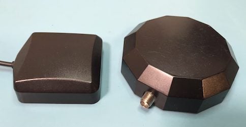
Mobile GIS: What to do with a GPS Antenna?
Posted by Matt on 3/17/2016 to
Adopting Mobile GIS
One of the things professionals have to get used to when they switch from submeter handheld GNSS equipment to mobile GIS workflows with submeter GNSS receivers is their antenna. The important thing to keep in mind is the antenna needs to “see” as much sky as possible and preferably at all times. Below we present a few methods for working with the external antennas used with Bluetooth GPS and GNSS receivers.
Arrow GNSS Interface App
Posted by AFS on 3/1/2016 to
Adopting Mobile GIS
At Anatum Field Solutions, our group prides itself on being both agnostic to equipment manufacturers and using this equipment in the field. We don’t do as much field work as we did working as biologists and environmental consultants before we started this company, but we still do a lot of field testing of equipment both independently and with our clients around the United States.

Bluetooth GPS/GNSS For Mobile GIS Field Tested and Compared
Posted by Matt on 2/18/2016 to
Adopting Mobile GIS
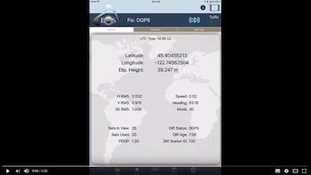
As an agnostic reseller and rental company of GPS equipment for use with Mobile GIS workflows, it is important that we know how the market performs. There are a multiple Bluetooth-capable GPS and GNSS receivers on the market now and we tested and compared them in real-world settings on our GPS Test Course. These field tests compared the accuracy and precision of Bluetooth submeter-rated GNSS receivers under conditions that ranged from open-sky to heavy canopy cover.
Geneq iSXBlue II Receiver Interface App Tutorial
Posted by AFS on 2/16/2016 to
Tutorial Videos
Tutorial video for the Geneq iSXBlue II GNSS receiver on iOS.
Using Tablets in the Field: A Case Study
Posted by Matt on 1/18/2016 to
Adopting Mobile GIS
Based on the results of our 2013 and 2014 case studies, we found the quality of data from using the mobile technology likely improved by eliminating potential errors introduced during the manual transfer of data from paper datasheets to an electronic database. The efficiencies gained in the documentation and distribution of the data resulted in substantial cost savings, even when considering some of the upfront costs of training and pre-survey preparation of automated data forms and creation of the Project specific GIS data in the mobile GIS app system. In addition, this technology is extremely adaptable and can be applied to survey data in a variety of disciplines aside from biology, including documentation of cultural resources surveys, geotechnical data, and other engineering data that may be needed for the Project.
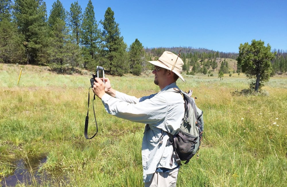
Using Tablets For Data Collection to Increase the Efficiency of Aerial Surveys
Posted by Matt on 1/18/2016 to
Adopting Mobile GIS
Recent technological advancements in the form of tablets with mobile GIS software paired through Bluetooth with external GPS receivers are providing new opportunities to aerial surveyors that can substantially increase efficiency and accuracy while simultaneously reducing potential impacts to wildlife. GPS receivers that we have used include the Arrow 100 for submeter accuracy and the Bad Elf GPS Pro with 2.5-meter accuracy. The appropriate GPS receiver depends on your projects accuracy requirements.
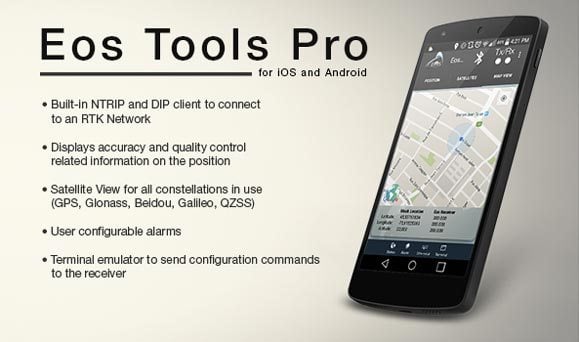
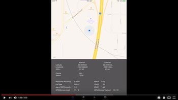
EOS Arrow GNSS Receiver Interface App Tutorial
Posted by AFS on 1/5/2016 to
Tutorial Videos
Video tutorial for the interface app by Eos for the Arrow receiver product line. Eos Tools Pro for iOS.

Nationwide BYOD RTK GNSS Rental Press Release
Posted by AFS on 1/1/2016 to
Adopting Mobile GIS
Anatum Field Solutions has decades of experience using high-accuracy GNSS receivers in the field. We’ve tested and used many different types of GNSS receivers, mobile devices and mobile GIS software. By renting from us, you’ll benefit from our objective opinion on the best GNSS mapping solution to fit your needs, and we have a technical support group to back you up. We are the only BYOD-centric rental company in the US that supports all operating systems (iOS, Android, Windows, Windows Mobile/EHH) with centimeter and submeter GNSS receivers.
UAV Power System Technologies Examined
Posted by AFS on 5/8/2015 to
Drones
Current technology on UAVs provides variations of a few systems, all gas, all electric (lithium), solar power to charge onboard lithium batteries, hybrid gas-powered generators that charge onboard lithium batteries, fuel cell batteries, and lastly tethered drones running like a vacuum would. I’m not sure which system is going to prove to be the most versatile, but here is a discussion of the technologies as they stand today.
Bad Elf GPS Compared to iPhone and iPad GPS
Posted by AFS on 1/4/2015 to
Knowledge Base
We are often asked by friends and clients why they need an external GPS when their phone or tablet already has an internal GPS. We have three answers for that. Click through to see more.

GNSS User Best Practices
Posted by AFS on 12/28/2014 to
Adopting Mobile GIS
This article will focuses on the various types of measurement biases and errors can be encountered; some of which is hardware instrument error and some user.
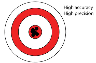
Accuracy and Precision Related to Surveying
Posted by AFS on 12/28/2014 to
Knowledge Base
This article defines both "Accuracy" and "Precision" and how they differ.

Brief Introduction to GPS and GLONASS
Posted by AFS on 11/16/2014 to
Knowledge Base
This post discusses simplified descriptions of GPS and GLONASS, and a follow-up post will discuss User Best Practices to keep in mind for achieving the most accurate data.
Welcome to our online store
Posted by AFS on 6/4/2014 to
Product News
Welcome to our online store! Our team is proud to announce that we have updated our website and believe it is now easier to navigate and complete purchases or request rental quotes. We look forward to continuing to serve our existing clients and new ones.
