
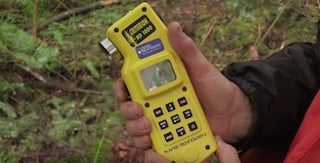
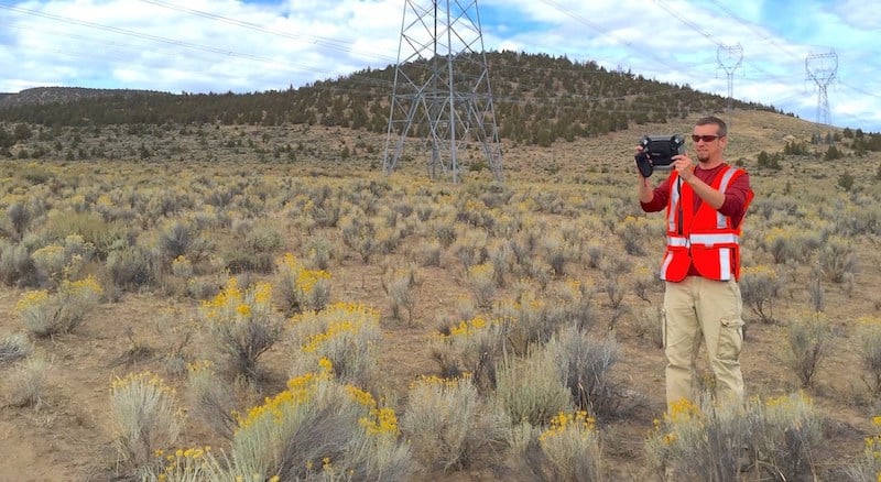
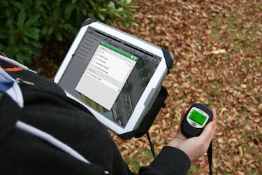
Criterion RD 1000 Basal Area Factor-Scope and Dendrometer Explained
Posted by Tyler on 4/2/2018 to
Tutorial Videos
Tutorial video on the Criterion RD 1000 as explained by our former President Jon Aschenbach.
Laser Technology’s Criterion RD 1000 is the first electronic BAF-scope and dendrometer that is capable of visually determining if trees fall in or out of a given plot as related to a specified Basal Area Factor (BAF). It also internally computes the limiting distance for questionable, borderline trees and determines if they are in or out of the plot. It measures the diameter of a tree at any given height and provides the ability to determine the height at which a specific diameter occurs. This video demonstrates how to timber cruise and determine if trees are in or out of a sample plot and how to measure a diameter of a tree.
Anatum Named A Top 25 Field Service Provider in 2017
Posted by Matt on 1/22/2018 to
Product News
Anatum has been honored with the acknowledgment as one of CIO Applications magazines Top 25 Field Service Solution Providers in 2017!

Everything You Need to Know About GPS for Switching to Mobile GIS
Posted by Matt on 1/15/2018 to
Adopting Mobile GIS
This article will break down the nitty-gritty of today’s GPS equipment and how to use the newest Bluetooth-enabled GPS receivers with your phone or tablet to get the best out of your Mobile GIS field data collection.
It was originally published in the Fall 2017 Volume 10 Issue 1 of BayGeo Journal.
Matt and Esri Co-teach Collector Workshops
Posted by Matt on 6/28/2017 to
Adopting Mobile GIS
Anatum's very own Matt Alexander teaches the technology portion and explains GPS technology and user best practices alongside the Esri staff with their focus on Collector for ArcGIS.
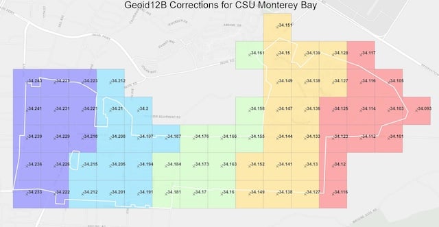
CSU Monterey Bay Tackles High-Accuracy RTK and Elevations with Collector
Posted by Matt on 5/19/2017 to
Adopting Mobile GIS
To capture horizontal (horizontal datum NAD83) and elevational data (vertical datum NAVD88), the university needed to determine first the required accuracy and if there was an affordable technology solution that could accomplish the task. By working with the GNSS experts at Anatum Field Solutions and their review of Bluetooth GNSS options, the EOS Arrow 200 RTK-GNSS using Esri’s Collector app, paired with an existing campus base station transmitting centimeter-level RTK corrections via the Internet, met all requirements for horizontal accuracy.
However, they needed to capture the vertical datum in NAVD88. This explains the differences between Height Above Ellipsoid captured by Mobile GIS apps and how to convert that elevation data to MSL (NAVD88).

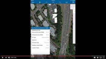
Adding GNSS Metadata Fields for Esri Collector
Posted by Tyler on 5/11/2017 to
Adopting Mobile GIS
Users can now power up their Esri Collector with automatic GPS satellite metadata fields collection. Use Collector to capture horizontal & vertical accuracy from your external GPS or GNSS receiver.

Are You Taking Full Advantage of Your Esri Software?
Posted by Matt on 4/10/2017 to
Adopting Mobile GIS
Ready to move from old-school GPS handheld data collectors to high-precision tablets? Ready to work in real-time between field collection staff and office management? Already an ESRI ArcGIS user? Get ready to learn how Mobile GIS can make your life easier and more efficient!
Four Satellite Constellations for Arrow 100
Posted by AFS on 3/31/2017 to
Product News
The submeter Arrow 100 GNSS has the ability to track and use all four available constellations simultaneously! No upgrade cost required!
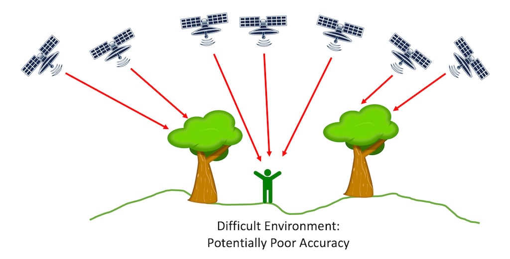
What is PDOP? And Why it's Obsolete
Posted by Matt on 3/15/2017 to
Knowledge Base
What is PDOP, HDOP, and VDOP? What do the values mean?
This article provides answers to all that and the reasons why GPS/GNSS users should have been ignoring them for a while now.
Are Rentals a Better Deal Than Buying?
Posted by Matt on 2/9/2017 to
Adopting Mobile GIS
Is Renting your field equipment like GPS and rugged tablets a better financial decision than buying?
Well, that depends, but the answer is likely Yes.
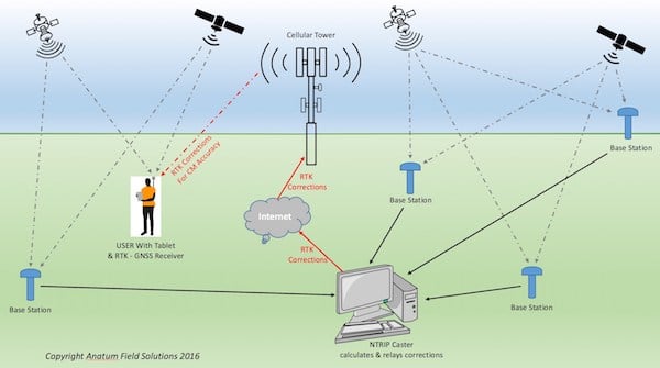
What is NTRIP?
Posted by Tyler on 2/7/2017 to
Adopting Mobile GIS
This article breaks down the explanation of how RTK and NTRIP work to get field users centimeter level accuracy in real-time.
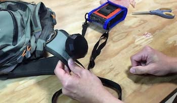
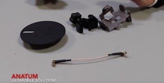
DIY Antenna Clip for iSXBlue and Arrows
Posted by Matt on 1/18/2017 to
Tutorial Videos
While we still recommend holding external antennas with either the GPS Hat, GPS Vest or a range pole for the best results with submeter GPS/GNSS receivers, we recognize that the GPS Hat isn’t the most stylish article of clothing in your closet. This video shows how to DIY your own clip attachment for the external antenna used by the Arrow and SXBlue receiver product lines.
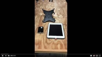
DIY External Tablet Battery Mount for Range Pole
Posted by Matt on 1/17/2017 to
Tutorial Videos
Short video on how to create a custom battery pack holder for your iPad to attach to a range pole.

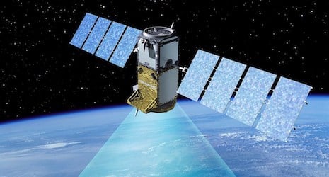
Galileo Satellite Constellation
Posted by AFS on 1/1/2017 to
Knowledge Base
The Galileo system will have all brand new cutting-edge satellites technologically comparable to the U.S. GPS satellites and expectedly more reliable than the Russian Glonass satellites. But the best part is that the Galileo satellites will be able to add more available satellites to receivers capable of tracking more than two constellations simultaneously.
How to Assemble Pole Mounting Kit for Eos Arrow 100
Posted by Matt on 12/28/2016 to
Tutorial Videos
How to mount Eos Arrow 100 GNSS or Lite GPS to range pole. Also mounting the Arrow 100 antenna to antenna mounting plate to attach to top of pole.

Anatum's Expertise Displayed in ESRI Newsletter
Posted by AFS on 12/19/2016 to
Adopting Mobile GIS
Anatum’s depth of experience working with Esri’s Collector and GNSS Equipment for Mobile GIS Solutions for enterprises was published in Fall 2016 edition of Esri News for Water & Wastewater
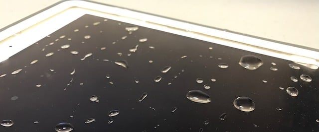
How Waterproof is that Unit?
Posted by Tyler on 12/6/2016 to
Knowledge Base
One of the first couple questions users often ask about tablets, lasers, or GNSS receivers is how waterproof it is, especially those in the Pacific Northwest! This breaks down the different waterproof ratings.
Bad Elf GPS Interface App Tutorial
Posted by AFS on 11/8/2016 to
Tutorial Videos
Quick tutorial video for the Bad Elf GPS ios app for phone or tablet.
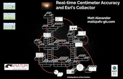
Real-time Centimeter Accuracy and Esri's Collector App
Posted by Matt on 10/27/2016 to
Conference Presentations
This talk was presented at the 2016 NWGIS User Group Conference in Salem, Oregon. It highlights how Esri's Collector app can easily work with RTK equipment like the Eos Arrow 200 and Arrow Gold.
Adopting Mobile GIS
Posted by Matt on 10/17/2016 to
Adopting Mobile GIS
Adopting Mobile GIS Solutions
Important lessons learned from six years of implementations and thousands of hours in the field.
Announcing Eos Arrow Gold RTK
Posted by AFS on 10/16/2016 to
Product News
Eos Arrow Gold is World’s Most Advanced GNSS Receiver for Every Mobile Device
RTK GPS Explained
Posted by Matt on 10/16/2016 to
Knowledge Base
RTK GPS receivers are traditionally very expensive and their accuracy has been thought of as beyond the field mapping needs of most environmental and engineering firms, and government land management groups. However, with the introduction of Bluetooth RTK receivers for use with field tablets and mobile GIS, RTK’s potential has become less expensive to achieve and much desired. Add to that the availability of Bluetooth RTK receiver rentals from Anatum Field Solutions, and the continued progression of many companies into mobile GIS workflows with tablets becomes much easier and more affordable.
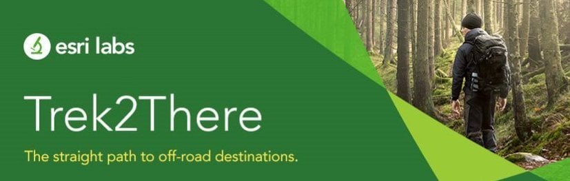
ESRI's Trek2There App
Posted by Matt on 9/2/2016 to
Adopting Mobile GIS
Esri's free app Trek2There is a simple app with little functionality; however, it does something clients ask us about from time to time. How do I navigate to a location with Collector?
Tutorial Video for Creating SBAS (WAAS) Correction Profile in Collector for iOS
Posted by AFS on 7/6/2016 to
Tutorial Videos
This tutorial video walks through the steps for creating a WAAS correction profile for submeter GPS for Esri's Collector app on iOS platforms. Update: Collector now includes the "Default" profile for submeter work with WAAS; however you can still manually set it if you prefer.
Tutorial Video for Connecting GPS/GNSS Receiver to Esri Collector for iOS
Posted by AFS on 7/1/2016 to
Tutorial Videos
This tutorial video walks through the steps for creating connecting an external Bluetooth GPS/GNSS receiver to Esri's Collector app on iOS platforms.
