
At Anatum Field Solutions, our group prides itself on being both agnostic to equipment manufacturers and using this equipment in the field. We don’t do as much field work as we did working as biologists and environmental consultants before we started this company, but we still do a lot of field testing of equipment both independently and with our clients around the United States. Here in Oregon, we have our own GPS Test Course that we have set up and use regularly to test equipment. The course has known points ranging from a clear sky (what all manufacturers base their accuracy on) to medium amounts of canopy cover, to solid canopy cover with our points located within about 1-foot of pine trees with 30? DBH. Needless to say, the gloves come off when we test equipment, and recently we tested 5 different submeter receivers from 4 different manufacturers. Look for our results to that testing soon, or email us and ask for an early copy of the results.

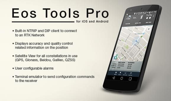
Along these lines, we have been spending a lot of time with the EOS Arrow product line of GNSS receivers. At this point, EOS Arrow GNSS interface app is really the best interface app for these type of receivers. The EOS apps for their receivers are EOS Tools and EOS Tools Pro for RTK. The only difference between the standard and Pro is that the Pro has the ability to connect to RTK networks if you are using the Arrow 200 to achieve centimeter accuracy. Not only do these apps look good, but EOS is actively updating them and making it better and more robust. That is the sign of a manufacturer that cares about its product and customers.
We have included some screenshots of the app, but the best part of this app and what sets it apart from the other manufacturers is the alarm page. On this page, the user can set a wide variety of alarms reminiscent of handheld GNSS units running ArcPad. To us, the most important alarm is the “Lost Connection” setting that causes the iPad to beep at the user if the Bluetooth connection to the Arrow receiver is lost. This is incredibly useful considering that without it, the user would not know if something had caused the connection to be lost. Other settings users might find most useful include setting the PDOP limit or the horizontal accuracy.
Say, for example, a user was conducting a wetland delineation that has a submeter accuracy requirement. They could set the horizontal accuracy alarm to 1 meter so they hear a beeping alarm any time they fail to achieve that accuracy.
As always, contact us if you have any questions about hardware, software, or workflows.
![]()
Tagged Products
