We all know a repeated challenge for wetland scientists isn’t the science, it’s the paperwork. In the field, paper, clipboards, notebooks and reference documents are cumbersome, bulky, and vulnerable to damage. In the office, handwriting is inconsistent, hard to read and time-consuming to transcribe. Chasing down data that was missed or needs correction creates more delays and ups the chances for errors. Dominant species calculations are another great opportunity to work late and make mistakes…and don’t even get me started on photo management.
The USACE has tried to make wetland reporting easier, but pre-cloud technology has created nearly as many problems as it has solved. Slippery, hard-to-format, online WORD documents and fillable pdf’s are a prime example. These information transfer mechanisms remain inefficient, ongoing sources of frustration for pretty much everyone who has to use them. Well, now you don’t!
Make it Rain
The cloud is where devices go to meet, and it has fundamentally altered the way data is shared and managed between people and organizations - most of the time, we don’t even know we are using it.
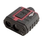
The good news is that you don’t have to wait for the USACE to implement cloud technology for wetland reporting, Wildnote has done it for you. Cloud-based data collection apps are popping up everywhere, but they aren’t all created equal. If you’re looking for a comprehensive solution that makes a meaningful difference in elevating your work, you want a tool that goes beyond being just a collection app. You want a tool that really serves your scope of work. Pairing your high-accuracy GIS equipment with a high-performance data collection, management & reporting platform will give you a high-value wetland determination solution.
About Wildnote

Wildnote technology provides solutions for organizations doing projects that require routine environmental compliance, long-term monitoring, ecological restoration, complex remediation, cultural resources management, and wetlands determination. Like other cloud-based data management systems, it has a library of pre-designed survey forms ready for use. Unlike other systems, it has an extensive suite of agency-required report forms ready to receive your exported data in the exact form the agency requires.
The platform’s solution for wetland determination reporting is unique within the industry. The tools work together to integrate wetland data from input to output to create faster, more accurate, more profitable work environments. These tools were developed in conjunction with, and vetted by, experts at the Wetland Training Institute. Ongoing review and monitoring through these partnerships assure that resource lists and report forms are updated and kept current.
What's in it For Me?
Wetland-specific tools allow you to export collected data directly into USACE Wetland Determination Data Forms for all 10 regions. Eliminating transcription creates more consistent data input and reduces errors. Automatically integrating photos and spatial data into wetland data forms improves efficiency and quality assurance. As a project manager in charge of creating a final jurisdictional delineation report, your life gets much easier.
Here, we are going to show you a top-level view of the Wildnote workflow for wetland data collection and exact export. For this example, we are using the wetland data form for the Atlantic & Gulf Coastal Plain region.
How to Set Up, Use, and Export a Wetland Project
As a project-based system, all of your components are stored together for easy access, queries, and reporting. So, the first step is to set up the following project parameters: top level project information, sample point list, survey forms, users, project documents and anticipated taxonomy. Projects and survey forms are set up, edited and managed using the web application, while data collection is done using the mobile app. The following images show what the Wildnote interface looks like on the web application.
1. Enter Top Level Project Information
2. Set up Sample Point Project Locations
It is key to set up and name your sample points on the web app before your team goes out in the field. That way, the corresponding sample point name stays part of the file name when you save a survey form offline. This allows you to easily reference, find and edit data in a previously saved survey form while in the field working. It is unlikely that you will know the exact number of sample points you will be testing for a wetland delineation project, so the best practice is to create more sample points than you will actually need, as there is no way to add them on the fly using the mobile app. The following image shows the project admin sample point set-up page.
3. Pick Your Regional Wetland Survey Form Template from the Library
Wildnote has an extensive library of forms, including the USACE wetland forms we are exploring here. You simply check the box next to the form you would like to copy and save. When you save it, it becomes part of your organization’s ‘library’. That library will include templates you have saved and templates you have created and or customized for your use. In this example, we’ve selected WET-03 Atlantic & Gulf Coastal Plain Region.
4. Edit the Wetland Survey Form Template
Once you’ve selected the template you want, you need to set it up for your project as described below.
4a. Define Default Answers
To save time and errors in the field, you may specify default answers in advance via the web app. You can set up your survey form to automatically populate fields with any information that stays consistent. In the image below, the default answer to the City/County question is set to Virginia Beach, Virginia.
4b. Choose Your State Taxonomy List
One powerful aspect of the Wildnote platform is the ability to selectively incorporate our extensive taxonomy lists into any survey form you build. When using the wetland forms, you’ll need to select the USDA Plant List for the State in which you’ll be conducting your work. The image below shows the USDA Alabama Plant List.
4c. Pre-seed Your Taxonomy Lists
If you know the plants that you are likely to encounter on your project, you can select them in advance via the web app as Taxon Favorites. That way, they filter to the top of the taxonomy list on your mobile device and you won’t have to search for them while in the field. The image below shows a list of plants that have been selected.
5. Assign Members
The Wildnote system is a “by invitation” system where team members are given one of three levels of data and project access. Invite your team members by email via the web app. Each member then sets their own password for access to the system. To assign team members, select MEMBERS from the Project Admin drop-down list.
6. Load Project Documents
Are you tired of lugging binders with important reference documents into the field? No more! Simply select DOCUMENTS from the Project Admin drop-down list and upload any relevant reference material that you or your team may need access to, such as the soils manual.
7. Collect Data
Once you have set up your project on the web app, then you can download the Wildnote mobile app from either the iOS or Android app store. Log in, Sync All, and then collect your field data. The screenshots below show the mobile app interface on an android phone.
A. After you log in and Sync All, select your project | B. Select your survey form, then click Start collecting data |
C. Taxon Favorites selected within the web app show up at the top of the list on your mobile devices | D. Wildnote automatically calculates and selects dominant species indicator status for your reports unless you tell it not to. The fields remain empty until you Save and Exit and sync your survey. |
8. Export your USACE Wetland Determination Data Forms
Once you’ve finished your work in the field using the mobile app, you move to the web app. The beauty of adopting this new workflow is that your reports are automatically generated right from your survey forms with no transcribing. The Review and Edit process gives you the opportunity to override system generated calculations, enter the Summary of Findings, and make corrections during QA. You can run exports via the web app for a single date, or a date range. The image below shows a partial Preview of the first page of a wetland determination data form report.
The image below shows the sample report page with completed auto calculations.
9. Photo Management and Reporting
One of the best parts of automating data collection, management and reporting, is how easy photo management becomes. With Wildnote, when you take a photo from within a survey form, latitude and longitude points are automatically generated. You can also add captions. The photos are easily accessible in the Gallery view. Photos and associated data are dynamically linked so you can toggle between them. You can also select Rename All Photos and the system will replace the generic sequenced-number names for all photos in a project with meaningful names generated according to that project’s parameters. Captions and latitude/longitude metadata stay attached.
To quickly generate photo reports for your jurisdictional delineations, simply go to the export window via Manage Data and click Photo Sheet PDF. There you will have the option to choose 2 or 4 photos per page. Captions are included in both. The image below shows the Wildnote Export window with Photo Sheet selected.

The image below shows a 4 Photos Per Page photo sheet report with captions.
Adopting a new workflow can seem daunting, but the learning curve happens once, while the benefits repeat over and over on every project. Using the off-season to explore and adopt new technology helps take the pressure off. You can find out more about
Wildnote’s comprehensive platform and start a free trial, or
schedule an online demo here.